Policyholders may see adjusted insurance costs based on their property’s unique flood risks
Key takeaways
- The Federal Emergency Management Agency (FEMA) introduced a new methodology for determining a property’s flood risk.
- Insurance rates will adjust as a result.
- This methodology offers more transparency.
- Learning about your risks can help you make informed insurance decisions.
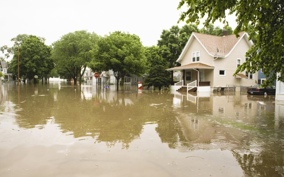
FEMA’s National Flood Insurance Program has an updated risk-rating methodology that changes the rates policyholders pay for flood insurance. The new method aims to deliver rates equitable to a property’s actual flood risk, so some homeowners will save money, and others will pay more.
Previously, FEMA utilized flood zone maps to identify overall risk in a particular area, increasing rates for properties with a higher likelihood of experiencing a 100-year flood event. But FEMA discovered that generalizing in this manner wasn’t accurately reflecting the risk for many homeowners and causing some with lower-valued properties to pay higher rates than necessary. The government hadn’t updated its methodology since the National Flood Insurance Act of 1968, so a change was probably overdue.
Here’s a look at the methodology behind Risk Rating 2.0, along with some information on who will pay higher insurance premiums because of it.
When Risk Rating 2.0 became standard
This new methodology is entirely up and running, so every new or renewed policy will be under this system from now on. Risk Rating 2.0 was also grandfathered in starting on October 1, 2021, with phase one. Phase one saw all new policies fall under this methodology and gave existing policyholders who would be saving on their premiums the chance to take advantage of it.
Phase two came into effect on April 1, 2022. This stage subjects all renewals to this methodology, so every flood insurance policyholder in the country will be under the new rating system by March 31, 2023.
A look at the methodology
The old methodology used static measurements to calculate insurance rates. Significant emphasis was put on a property’s elevation within its zone on a Flood Insurance Rate Map. However, this approach ignored many variables that could increase or decrease the risk to a property. And the new methodology addresses these variables.
First, Risk Rating 2.0 looks at the overall probability of inland flooding in an area. Just because a community sits at a low elevation doesn’t necessarily mean it has a significant flood risk. However, this new system does incorporate elevation into the formula because it remains a risk factor. Identifying the probability of inland flooding also involves looking at historical data for storm surges. Neighborhoods that are hit by the occasional storm surge, for example, could be riskier despite sitting in an inland location. The same goes for areas near bodies of water that frequently encounter storm surges.
Risk Rating 2.0 also looks at barriers and other surroundings that could protect a community from floodwaters. Natural features like marshes, wetlands, mangroves, dunes, and coral reefs can minimize flooding in nearby neighborhoods by either blocking the water or giving it a place to run.
Historical data is also a vital part of Risk Rating 2.0’s methodology, as the formula incorporates past losses into the equation. So, those who live in a community with a history of flood damage should expect higher rates.
Finally, the cost of rebuilding a particular building is part of this methodology. As a result, higher-value homeowners will pay more for flood insurance than those in the same community with lower-value homes.
Collectively assessing these factors creates more accurate flood insurance rates for most Americans.
What isn’t changing in Flood Risk Rating 2.0
With so many aspects of flood insurance changing, it’s worth going over the statutory requirements that FEMA is upholding.
First, the existing limits on rate increases will remain in place. As a result, your premiums cannot rise by more than 18% per year.
In addition, Flood Insurance Rate Maps will remain for mandatory insurance purchases and floodplain management. So, although these maps won’t be the primary methodology for determining your rates, FEMA will still use them to define communities that must purchase flood insurance and identify high-risk areas requiring special floodplain management building requirements.
Some policyholders can also keep the premium discounts they earned under the old system. Policyholders who received subsidization before the introduction of the Flood Insurance Rate Maps can retain those discounts, as can newly mapped properties. Policyholders can also transfer these discounts when they sell their property by filling out the correct paperwork.
Communities that participate in the Community Rating System can keep their discounts, too, which are between 5% and 45% reductions based on the area’s classification. However, these discounts will now be applied uniformly to all properties throughout the community because flood zones are now non-applicable.
What the changes mean for consumers
Overall, Risk Rating 2.0 is likely a positive for consumers because it provides more transparency for policyholders and more accurately reflects a property’s flood risk.
Overall, 23% of existing policies will get less expensive, saving 1.2 million people some money. These savings are most prevalent in DC, Maryland, Michigan, and Utah, where at least half of all policies will see reduced rates. In New York, nearly 17,000 policyholders will save more than $100 per month, while only 247 property owners will see increases above $100 monthly.
Nationally, 3.6 million homeowners will see rates increases, with certain parts of the country being harder hit than others. For example, 87% of policies will see higher premiums in Hawaii, while that number is about 86% in Texas.
Private flood insurance could become more popular, too, as more providers get into the market due to these new rules making the industry financially viable. The result is more options for consumers when seeking the best flood insurance rates available.
Purchasing flood insurance
If you don’t already have a flood insurance policy, it’s worth considering because of the essential protection it provides. And this new methodology ensures you’re paying based on your property’s more accurate risk profile.
It’s worth noting that many private flood insurance providers offer higher minimum protection levels compared to government insurance. And you must carefully vet a private insurer’s financial stability, among other factors, because they don’t receive government backing.
NICRIS Insurance offers advice on the best policies to protect your property and family. Our team can provide you with a free, personalized insurance review, ensuring your policy matches your potential risks.
Contact NICRIS Insurance today with any insurance questions or to receive a free quote.